GPS Satellites: Time-Dependent Transmitter Locations
GPS satellites are time-dependent satellites. These satellites should be analyzed over time.
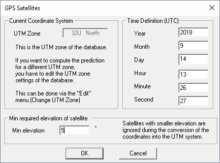
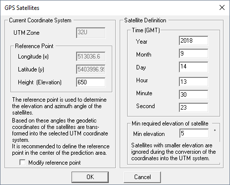
ProMan offers the possibility to define time (UTC time) and a location on the globe (coordinates of a location in an arbitrary UTM zone, based on WGS 84 coordinate datum) - and then the location of the satellites relative to this location is computed by ProMan automatically.
After downloading the dataset for the week of interest, you can compute the time-dependent locations of the GPS satellites for all locations on the globe.
Creation
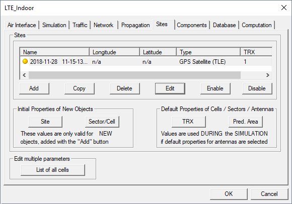
Click and click the Sites tab to get an overview of the currently considered sites.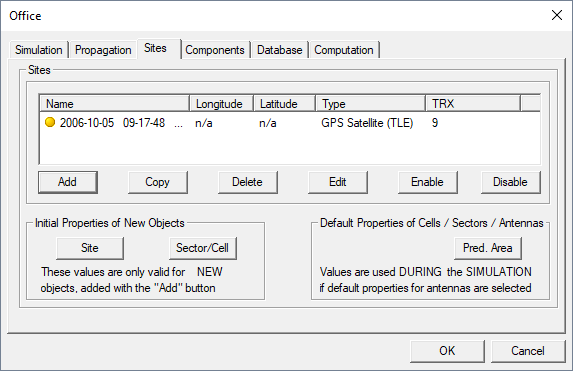
- Clicking on the Add button on the Sites tab of the Edit Project Parameters dialog
- Using a mouse tool which can be activated via
- the menu
- The
 icon in the
Project toolbar.Note: The mouse tool can only be used if the project dialog is not displayed. If the Project dialog is displayed, new transmitters can only be entered via the Transmitter tab of the Edit Project Parameter dialog.
icon in the
Project toolbar.Note: The mouse tool can only be used if the project dialog is not displayed. If the Project dialog is displayed, new transmitters can only be entered via the Transmitter tab of the Edit Project Parameter dialog.
- Select the type of transmitter by one of the following methods:
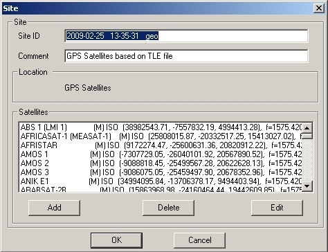
- Specify the name of the Almanac or TLE file.
- Select the file by clicking on the Change button.
Based on the orbit data (for example, given in the TLE-set) and the given time instance the satellite location(s) relative to the UTM zone (in which the geographic database used for the simulation is defined) will be computed. Accordingly, two new dimensions have been incorporated in the radio planning tool: satellite dimension and time dimension. Each defined time instance will lead to a specific site including the available satellites for the given time and location (for example, above the horizon or a defined minimum elevation angle).
Based on this moving satellite extension it is possible to compute the LOS areas and the received signal power for the defined satellites over time, which will be for example useful for the analysis of GPS performance.
All the converted satellites are displayed together with their coordinates in the Sites tab of the Edit Project Parameters dialog. By adding further sites, it is also possible to simulate various time instances and therefore to investigate the system availability over time. Each defined time instance will lead to an individual site (including the available satellites). All defined sites are listed on the Sites tab.