Add Virtual Buildings to Urban Database
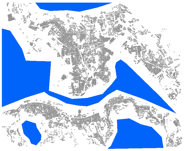
Virtual buildings are used in WinProp to exclude certain areas in an urban database from calculations. Often, it is desirable not to do a prediction in the whole rectangular area, which was defined at pre-processing time. For example, this is suggested if large areas of waters are within an urban database (for example, large rivers running through a town). Also, if parts of the database were not mapped, large open areas occur. These areas lead to a longer pre-processing time (for the IRT-model because visibility relations are computed for the open areas as well) although they are of no interest.
Therefore, virtual buildings can be entered before the pre-processing of the database. They are entered like normal buildings. In the pre-processing, no visibility relations to the pixels inside the virtual buildings are computed and therefore no prediction is computed within the virtual buildings. Additionally, no reflections, diffractions and transmissions are computed due to these buildings because this would, of course, lead to errors. This approach reduces the pre-processing and prediction time as well as the size of the pre-processed database.
To enter a virtual building, choose the Enter Virtual Buildings option from the Objects menu. This will put WallMan in a special mode where all entered buildings become virtual buildings. A banner in the upper-left corner of the window reminds you that WallMan is in virtual building mode. Just enter the virtual buildings as you would do with any other building.
When finished, choose the Enter Virtual Buildings option again to exit the virtual building mode. Virtual buildings appear in blue color making it easy to distinguish them from conventional buildings.

You can open the object properties dialog of a virtual building. It looks like the same as for a normal building only no material properties will be available. However, this procedure is convenient to change the coordinates of the corner numerically.