Working with Urban Projects
Propagation of electromagnetic waves in urban scenarios in the frequency range above 300 MHz is influenced by reflections and diffractions at the buildings. Therefore, a detailed vector database of the buildings is required.
Urban vector databases contain a description of each urban building or vegetation area in an urban environment. In contrast to the topographical or clutter pixel databases, the urban databases are vector databases, each building is described by a vector (polygon) and attributes (height, material, type (building, courtyard, tower, vegetation)).
- Each polygon can have an arbitrary number of corners. At least three corners are required to define a valid polygon (building).
- Each building has a uniform height (polygonal cylinder). The height is either relative to the ground or absolute above sea level. Absolute height values require additionally a topographical database.
- Flat rooftops are used (horizontal planes).
- Only vertical walls (parallel to z-axis) are allowed.
- Each building has a single set of material properties which are used for the whole building.
- The polygon of a building cannot intersect itself.
- The polygon of a building can intersect other polygons (buildings).
Types of Buildings
- Standard buildings
- These can be used to model a building in an urban environment.
- Courtyards & Towers
- This type of building is used to define a building which is totally inside a second building. If the inner building is higher this is called a tower and if it is lower it is called a court yard. Courtyards have the same material properties as standard buildings. But there is one big difference: While a standard building has no information about the situation above the building, the courtyard defines also the environment above the building. No standard building, vegetation building or virtual building is possible above a courtyard. Only courtyards above courtyards are possible.
- Vegetation buildings
- This type of building is used to model vegetation (for example parks, trees).
The
building
is transparent (the rays have no intersections (reflection, diffraction,…) at thebuilding
). The (part of the) ray inside thebuilding
(polygonal cylinder) has an additional loss (per meter) and the pixels inside thebuilding
(polygonal cylinder) have an additional loss. The vegetation buildings can also be used to model persons or cars (traffic) or all other objects which do not totally shadow electromagnetic waves and where a part of the wave is able to penetrate the object (with an additional loss compared to free space propagation). - Virtual buildings
- With this type of building only pixels are excluded from the prediction (all pixels inside virtual buildings are not computed to accelerate the prediction and reduce the memory requirements). The virtual buildings are transparent for all prediction models. So the rays can pass the building without any additional loss. Only pixels inside the virtual buildings will not be predicted to save computation time. Virtual buildings can be used at the border of the database where areas are free of buildings and which are of no interest. Or they can be used to exclude pixels in the middle of a river/lake in a city where predictions are not required.
Consideration of Topography
The topography can additionally be considered. Either the building heights in the vector database are defined inclusive topography or exclusive. This must be selected when preprocessing the database in WallMan. WallMan determines the topographical height of the center of the building and then either the relative height is obtained by subtracting the topographical height from the absolute building height (if absolute heights are given inclusive topography in the building database) or the absolute height is determined by adding the topographical height to the relative building height (if relative building heights are defined in the building databases).
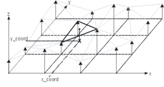
Arbitrary topographical databases can be used and converted with WinProp. Topographical databases are pixel databases and they are internally converted during the computation into a triangle approximation of the terrain profile.

Preprocessing of Databases
The raw format of the urban databases is the .odb format. These files can be created or converted with WallMan. To compute a prediction, the database should be preprocessed for all urban prediction models. This must be done with WallMan.The different prediction models require different preprocessing computations and thus different file types. When creating an urban propagation project, you can choose between the following database types:
| Database file extension | Description |
|---|---|
| .odb |
|
| .ocb |
|
| .oib |
|
| .opb |
|