Coast
Calculate propagation in a coastal rural/suburban scenario.
Model Type
The geometry is described by topography (elevation) and clutter (land usage). The clutter map, see Figure 1, describes which areas are, for example, residential, water, industrial, dense urban, villages, forest, and no data. The Database tree in the Tree view enables you to view the two displays, click either Topography or Clutter/Morpho.

Sites and Antennas
Computational Method
Results
Propagation results show the received power by a hypothetical omnidirectional receiving antenna at 1.5 m above ground at every location, as defined under the Simulation tab. For example, Figure 2 shows the results for Site 1 Antenna 1.

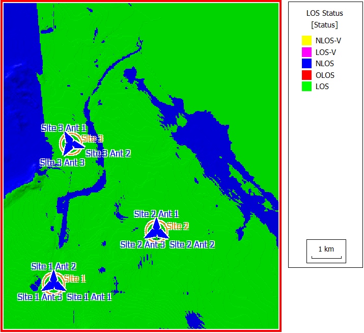
A line-of-sight analysis was performed and is shown in Figure 3.