With WallMan it is possible to convert databases from many
common database formats to the WinProp format.
The following file formats are supported:
WinProp indoor building data ASCII
(.ida)
AutoCAD file format (.dwg, .dxf)
Autodesk 3ds Max File Format (.3ds)
Autodesk Filmbox File format (.fbx)
Blender File Format (.blend)
Note: If a Blender file fails to import
into WallMan, export the Blender file into GL Transmission
(.gltf) format which can be imported into WallMan.
COLLADA (.dae)
Facet file format (.fac)
Geography Markup Language (.gml)
CityGML (.gml, .citygml
GL Transmission Format (.gltf, .glb)
Nastran file format (.nas)
Stereolithography file format (.stl) (Binary)
Stereolithography file format (.stl) (ASCII)
Stereolithography file format (.stl) (ASCII/Binary)
Wavefront file format (.obj)
OpenDRIVE (.xodr)
Tip: In case imported polygons are not perfectly flat, use Objects > Triangulate selected objects to fix this.
Convert Vector Database from OpenDRIVE Format
OpenDRIVE® is an open file format specification that is used to to describe large and
complex road networks. WallMan offers the possibility to
convert OpenDRIVE to an indoor vector database (.idb file). Although
the road geometry is of course out of doors, WinProp uses the
term indoor for any geometry that has significant geometrical freedom, which is the
case for road networks from OpenDRIVE.
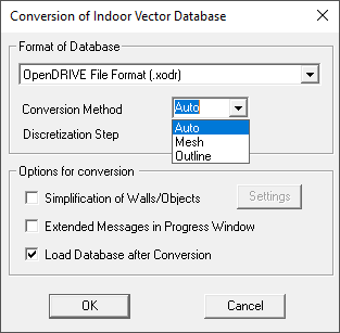
The converter is accessible by clicking on the menu, File > Convert Indoor Database > Vector Database. Then, select OpenDRIVE File Format (.xodr):Figure 1. The Conversion of Indoor Vector Database dialog.
Options are available for the conversion method and the discretization:
Convertion method
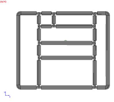
Outline
This conversion mode creates objects from the contour of the road lanes.
This mode does not take into account the elevation profile of the roads, if
any (i.e., it makes them flat).
Figure 2. Converted database with the outline conversion method. The objects lie in
the XY plane
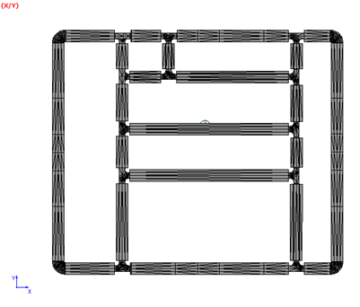
Mesh
This conversion mode creates triangular objects for the road lanes. This
approach takes into account the elevation profile of the roads. The
resulting database will contain more walls than the outline approach.
Figure 3. Converted database with the mesh conversion method. All objects are
triangles, follow an elevation profile if applicable.
Auto
This conversion mode converts planar roads with the outline method and
uses the mesh method for roads with elevation profiles.
Discretization step
The minimum discretization length in meters. Larger triangles will be created where
appropriate. In the image above, a minimum discretization step of 2 m was specified by
the user and was applied by the converter in the curves.
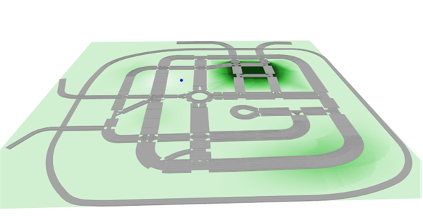
If the road network is not planar, a topography database (.tdb file)
will be created and saved along with the resulting vector database.Figure 4. Converted road network with elevation profile.