Profiles Menu

This option allows the user to manage the topographic profiles that are contained in the project. A topographic profile can be created by using any of the following methods:

  • By extracting them from the loaded terrain model.
  • By importing a text file that contains the points (distance and height) of the topographic profile.
  • By creating a topographic profile manually using the editor.

The first method of creating profiles has been explained in the previous section. It is possible to create a topographic profile from a text file or using the editor by using the options present in the "Profiles" menu.

The following figure shows the available options under this menu:


Figure 1. Profiles menu

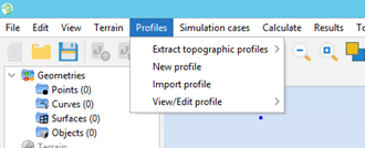
The available options are the following:

  • Extract topographic profiles: Allows the user to create new topographic profiles from the currently imported terrain model.
  • New profile: Creates a new (empty) topographic profile.
  • Import profile: Creates a topographic profile from the contents of a text file with the points of the topographic profile. The format of the text file needs to be:
    • First, any number of lines starting with "#" that will be ignored by the parser. These lines may be used as comments.
    • Then, any number of lines, each containing a point of the topographic profile. Each of these lines must specify the distance from the origin (in meters) and the height of the point (in meters). Both values must be separated by any number of spaces.
  • View/Edit profile: Under this submenu, all the topographic profiles of the project will be listed. Clicking on any of them will allow the edition of the profile.

Selecting any of these options will open the Topographic Profiles Editor, which will allow the user to edit the new or existing topographic profile.