Terrain Menu
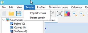
The Terrain menu contains options that work with terrains. The options are shown in the following figure:

The available options are the following:
- Import terrain: Allows the user to import a terrain model into the project. Terrain models can be used for extracting the topographic profiles that will be used in simulation cases. The user can import terrain models with the GeoTiff or ARC/INFO ASCII GRID formats.
- Delete terrain: Deletes the currently imported terrain model from the project.