Generating Topographical Data
Generate topographical data by using drawing tools and creating a matrix.
Topography is drawn in ProMan by using the pixel modification tool.
-
Click
This creates a new empty matrix.
Figure 1. The Coordinate System dialog. 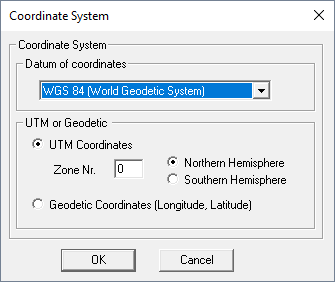
- In the Datum of coordinates drop-down list, select one of the listed items.
- In the UTM or Geodetic group, select an option.
- Click OK to continue.
-
On the Properties dialog, specify the matrix
dimensions.
Figure 2. The Properties dialog. 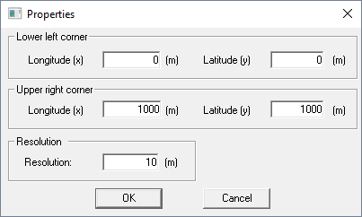
Note:The next dialog offers the selection of a background image. If no background image is required, the dialog can be canceled.
-
Specify the minimum and maximum elevation of the topography.
Figure 3. The Range of elevation values dialog. 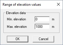
-
Draw the topography.
Note: Use the drawing tools to fill the matrix.
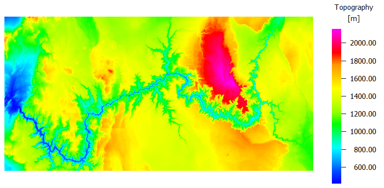
Figure 4. Example of a topography.