Connectivity in a Rural/Suburban Scenario
Calculate the propagation results for a rural/urban scenario with 98 transceivers spread across a forest.
Model
The connectivity model represents the city of Stuttgart and a forest area around it. No buildings are modeled explicitly. The description files consist of topography (altitude) and clutter (land usage). This type of scenario is called a rural/suburban scenario in WinProp. The model is to be opened with CoMan (Connectivity Manager).
Nodes
There are 98 transceivers placed at random locations in the forest. The node density in certain clutter classes was specified whereby CoMan generated and distributed the nodes.
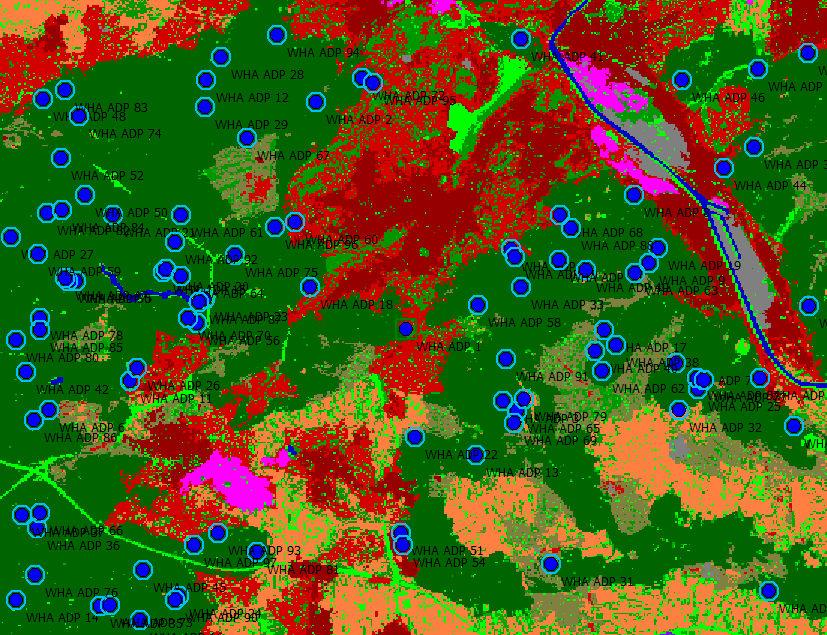
Figure 1. Forested area around Stuttgart with randomly distributed nodes.
Air Interface
Computational Method
Wave propagation computation is computed for all the nodes by selecting .
The next step is network analysis by clicking .
Finally, connectivity is determined by clicking .
Results
Propagation results are computed for field strength and power for all the nodes and can be viewed at ConnectivityExampleRuralSuburban\results\propagation.
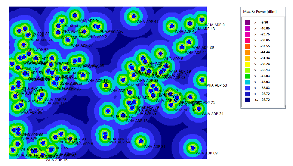
Figure 2. The maximum received DL power.
The connectivity between nodes can be viewed at ConnectivityExampleRuralSuburban\results\network. To view the connectivity between the nodes, activate Show Paths, and click on one of the nodes.
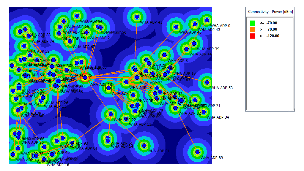
Figure 3. The connectivity between the nodes.